Interlaken Maps and Orientation
(Interlaken, Berne, Switzerland)
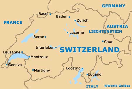
Located in central
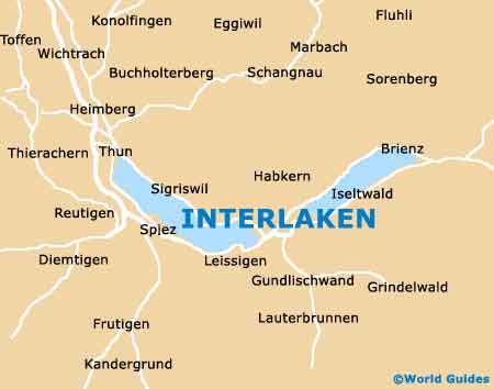
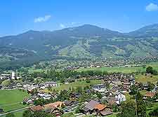
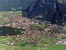
Switzerland, Interlaken lies within an area known as the Bernese Highlands (Bernese Oberland), being close to the Swiss Alps and the very prominent Jungfrau mountain. Interlaken is sandwiched between two huge lakes, with Lake Brienz lying to the east, and Lake Thun to the west.
Being sited in such a central position means that Interlaken is relatively near to many important Swiss cities and towns, with
Berne and
Lucerne being amongst the closest. The Aare River meanders its was through the centre of the town and along streets such as the Untere Goldey (Goldey Promenade), the Hauptstrasse and the Strandbadstrasse.
Maps and Orientation of the City
Central Interlaken is bounded by the towns two railway stations, Interlaken East (Ost) and Interlaken West. Each of the stations features it s very own cycle hire, currency exchange and regional maps. Behind each of the stations are useful landing stages for the lakes, Brienz and Thun respectively.
The two stations are connected by Interlaken's premier shopping street, the Hoheweg, being just a 30-minute walk from each other. For the best maps of the town and region, pay a visit to the Tourist Office, which is located on the Hoheweg and near to the West Station.
- Basel - 146 km / 91 miles (one hour and 40 minutes, north)
- Berne (Bern) - 56 km / 35 miles (50 minutes, north-west)
- Brienz - 17 km / 11 miles (20 minutes, north-east)
- Därligen - 5 km / 3 miles (9 minutes, south-west)
- Geneva (Genève) - 215 km / 134 miles (two hours and 20 minutes, south-west)
- Goldswil - 3 km / 2 miles (5 minutes, north-east)
- Iseltwald - 10 km / 6 miles (12 minutes, east)
- Lausanne - 160 km / 99 miles (one hour and 50 minutes, south-west)
- Lucerne (Luzern) - 67 km / 42 miles (one hour and 10 minutes, north-east)
- Meiringen - 28 km / 17 miles (30 minutes, east)
- Ringgenberg - 5 km / 3 miles (8 minutes, north-east)
- Spiez - 17 km / 11 miles (20 minutes, west)
- Thun - 29 km / 18 miles (30 minutes, west)
- Unterseen - 1.5 km / 1 miles (3 minutes, west)
- Zurich - 170 km / 106 miles (two hours, north-east)
Map of Switzerland
Map of Interlaken